
2026 OCP Housekeeping Amendments
Share 2026 OCP Housekeeping Amendments on Facebook
Share 2026 OCP Housekeeping Amendments on X (formerly Twitter)
Share 2026 OCP Housekeeping Amendments on Linkedin
Email 2026 OCP Housekeeping Amendments link
In December 2025, Council adopted an updated Official Community Plan (OCP), Abbotsforward 2050.
In the months following adoption, staff identified a small number of errors, omissions, and opportunities to improve plan clarity.
The changes contemplated through this housekeeping update are administrative in nature and do not change the foundational urban structure or growth policies of the OCP.
Proposed refinements are intended to improve clarity and intent, falling into the following categories:
- Land Use Designation Corrections & Clarifications
- Mapping Corrections
- Land Use Regulation Clarifications
- Neighbourhood Plan Clarifications
Public Hearing Scheduled
- A Public Hearing will be held on July 14, 2026, at 6:00pm at the Matsqui Centennial Auditorium, providing a final opportunity for the community to comment on the OCP housekeeping amendments proposed under Bylaw No. 3718-2026 (view the full Council report)
Recent Steps
- May 12, 2026 - Council granted 1st & 2nd reading to the OCP Amendment Bylaw and referred the changes to an upcoming Public Hearing
-
OCP Land Use Designation Corrections & Clarifications (1-11)
Share OCP Land Use Designation Corrections & Clarifications (1-11) on Facebook Share OCP Land Use Designation Corrections & Clarifications (1-11) on X (formerly Twitter) Share OCP Land Use Designation Corrections & Clarifications (1-11) on Linkedin Email OCP Land Use Designation Corrections & Clarifications (1-11) linkAmendment 1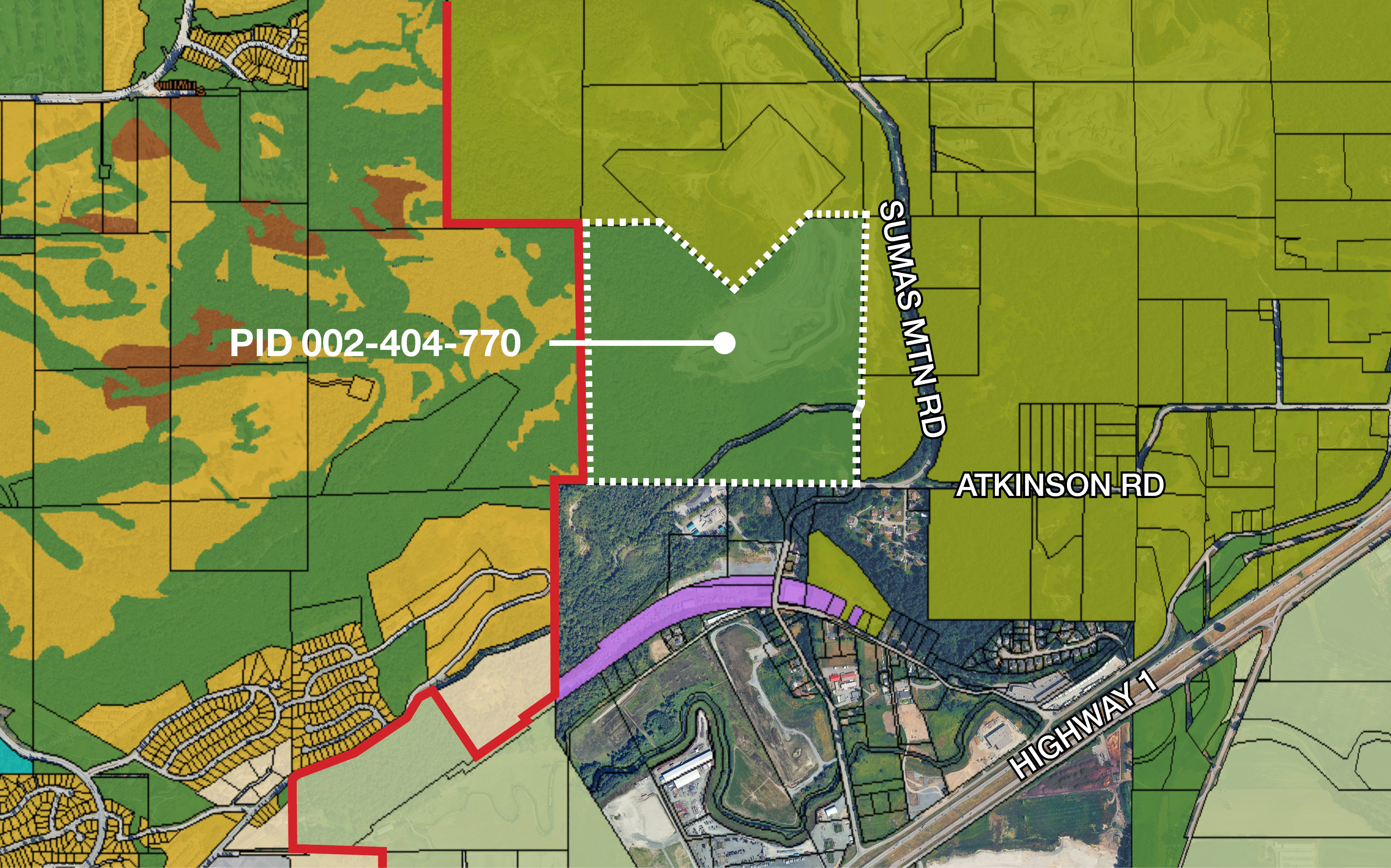
Where PID 002-404-770 (off Sumas Mountain Rd) Why Unintentional map change with Abbotsforward 2050 OCP designation today Open Space Corrected OCP designation Rural Amendment 2 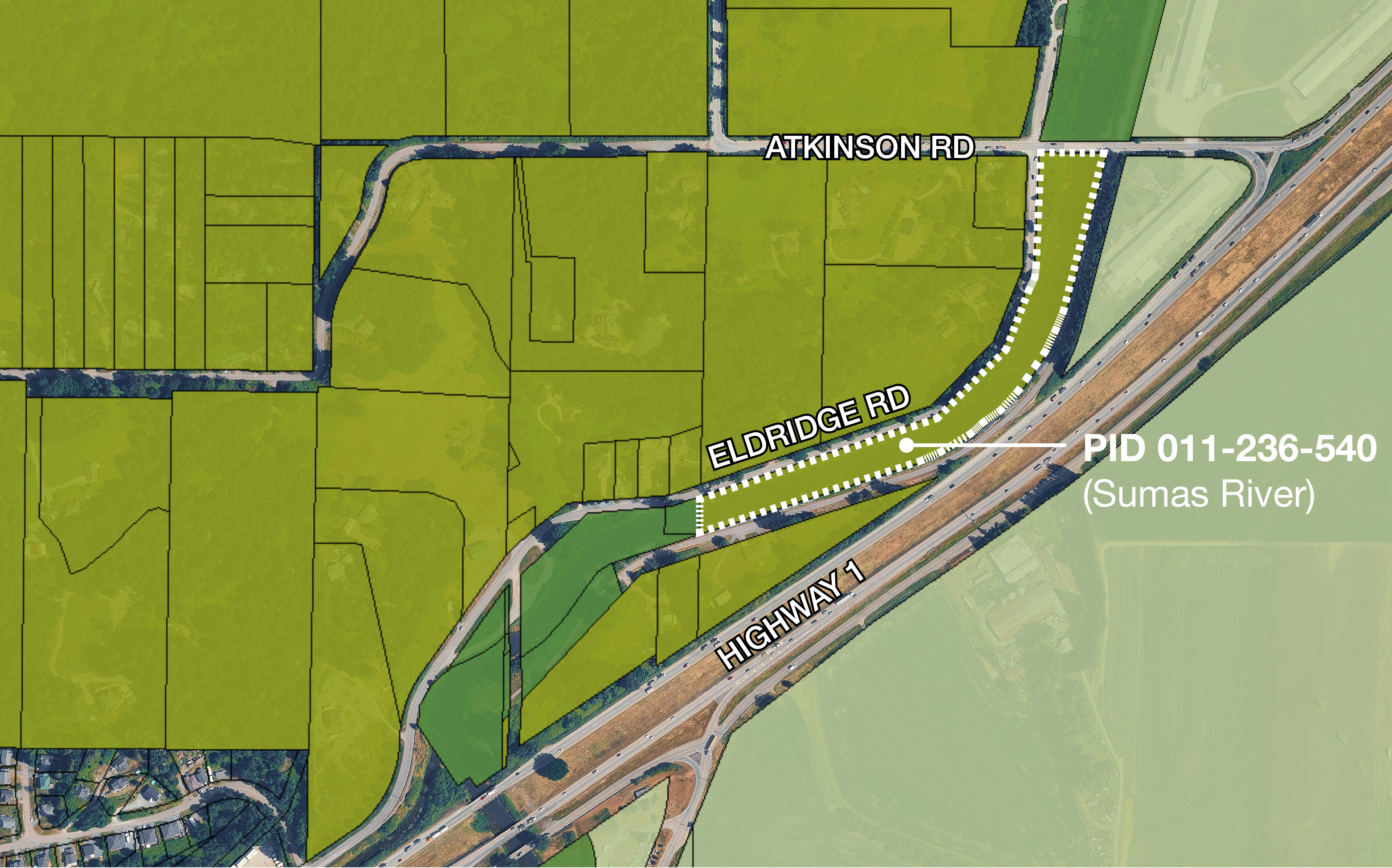
Where PID 011-236-540 (part of Sumas River)
Why Unintentional map change with Abbotsforward 2050
OCP designation today
Rural Corrected OCP designation
Open Space Amendment 3 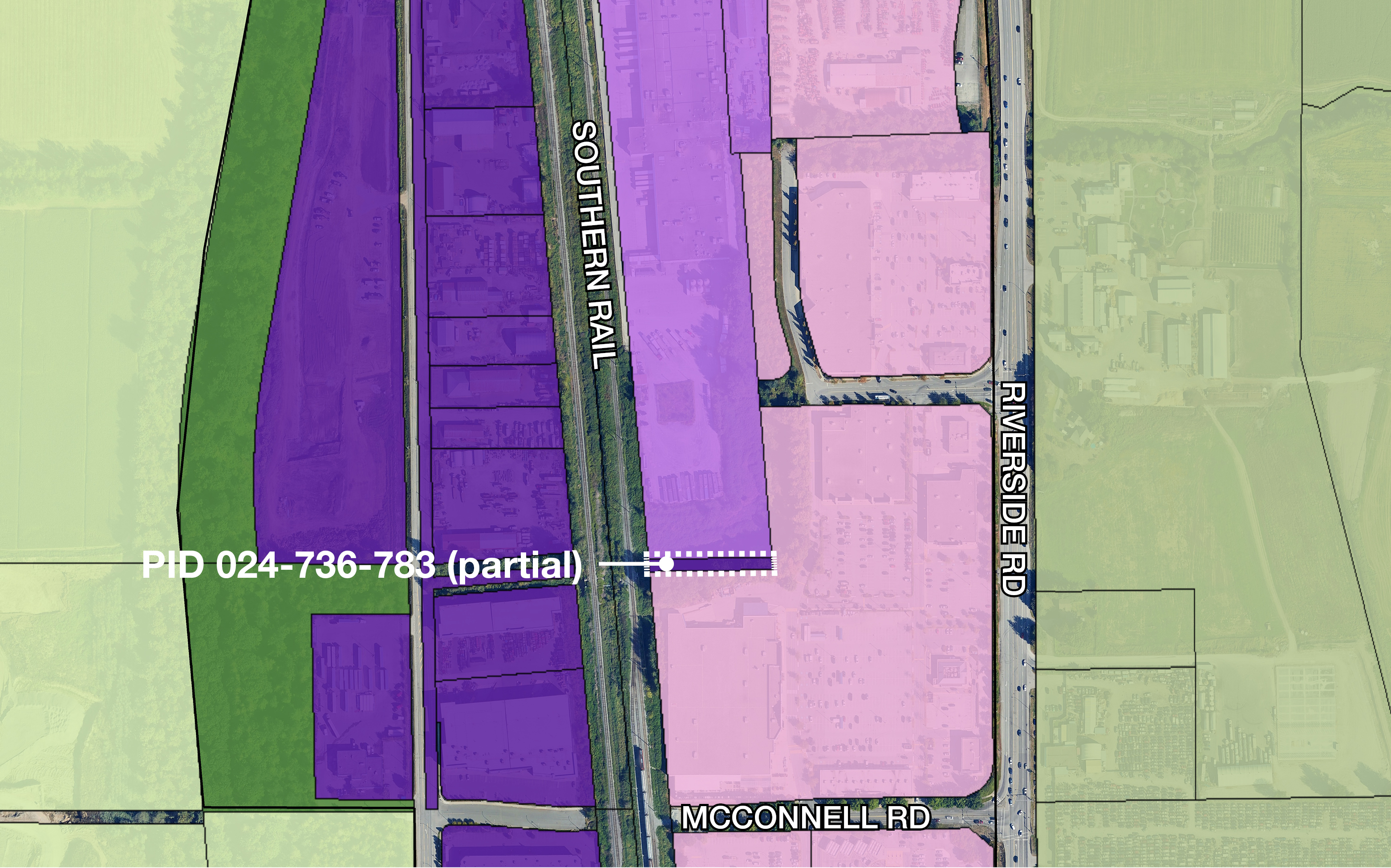
Where Part of PID 024-736-783 (sliver of land near Winners) Why Unintentional map change with Abbotsforward 2050
OCP designation today
High Impact Industrial Corrected OCP designation
General Industrial Amendment 4 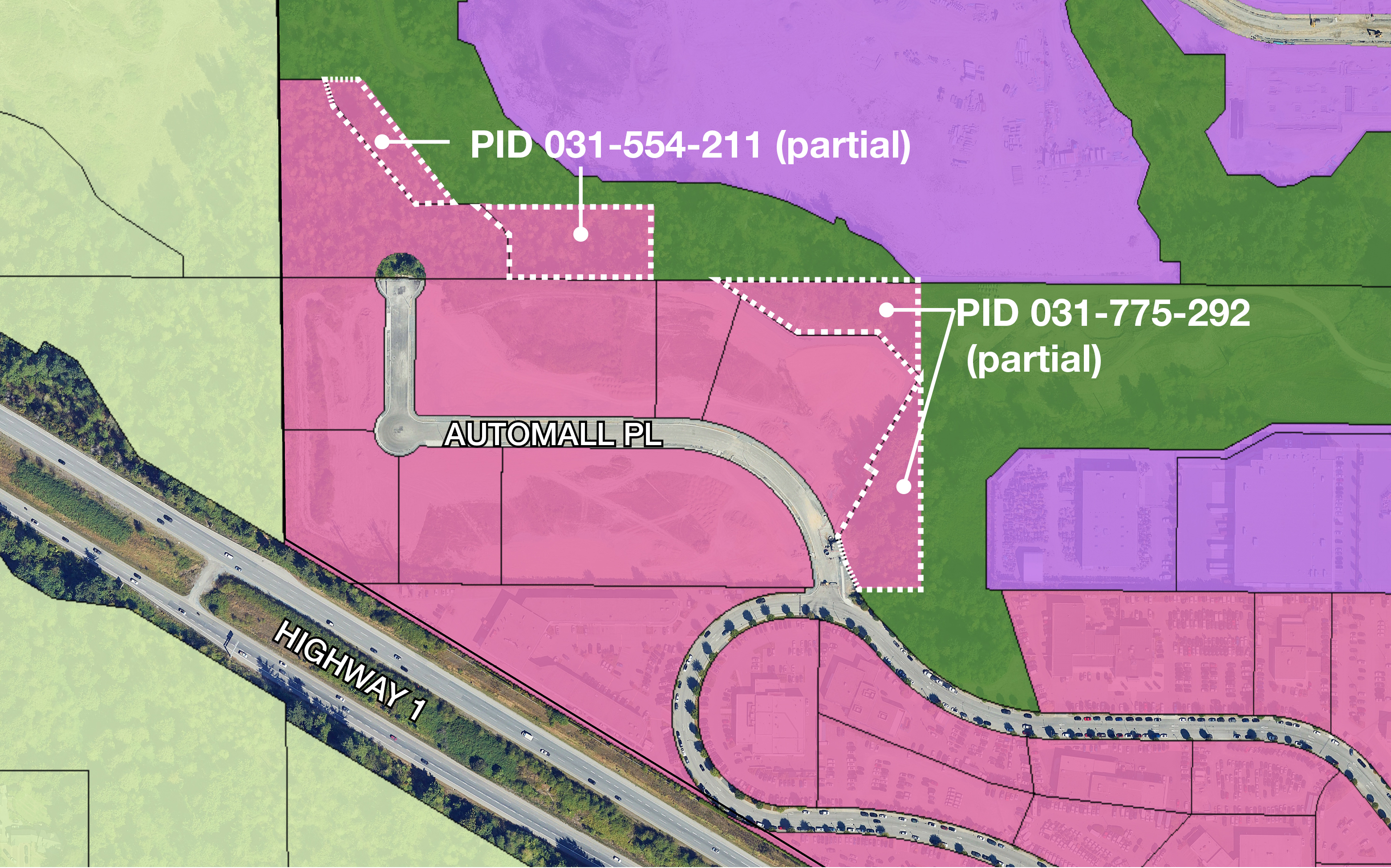
Where Part of PIDs 031-554-211 & 031-775-292 (near Automall) Why Missed Open Space OCP designation today Secondary Commercial Corrected OCP designation Open Space Amendment 5 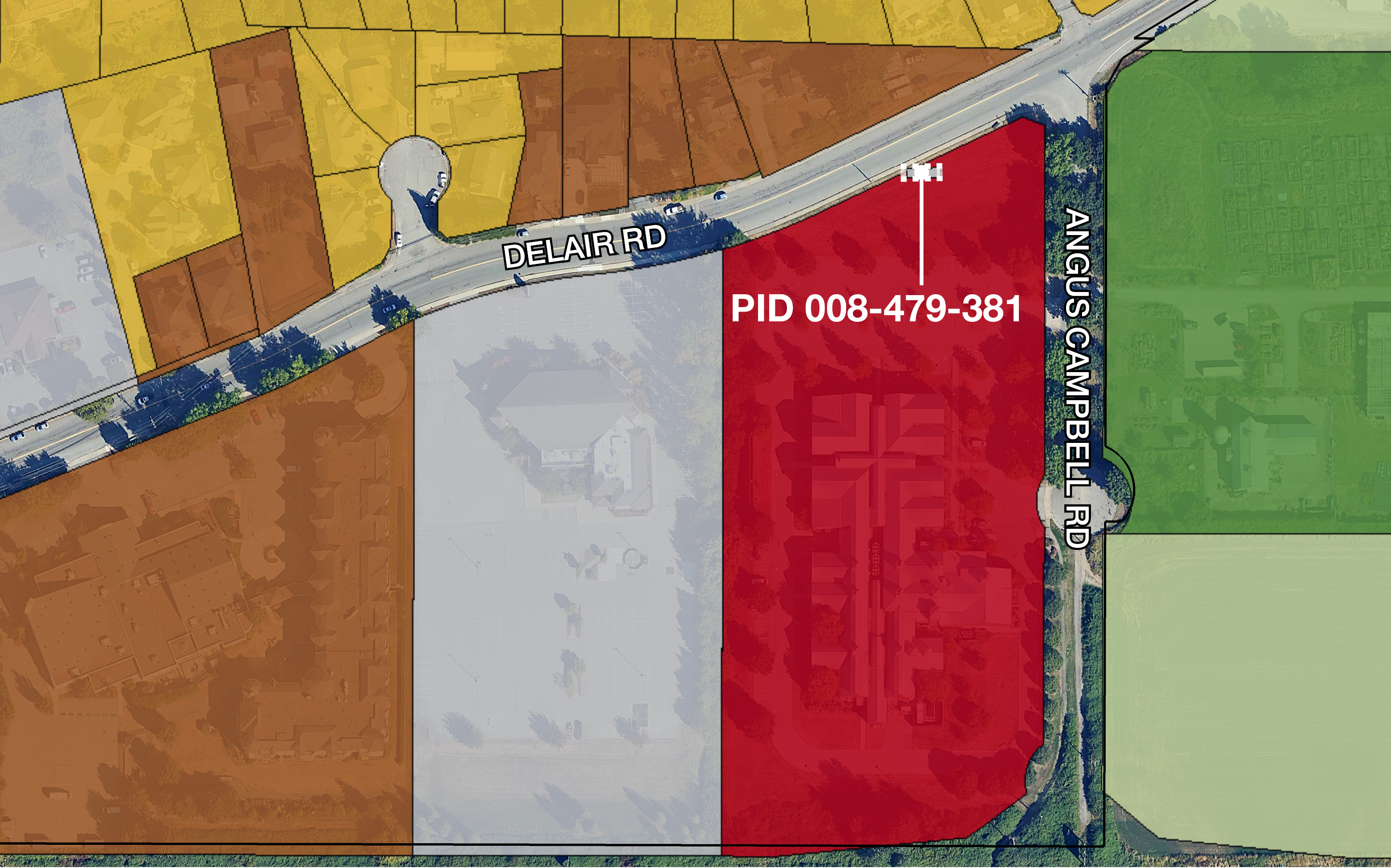
Where PID 008-479-381 (portion of 1767 Angus Campbell Rd) Why Missed parcel fragment OCP designation today Institutional Corrected OCP designation Apartment Amendment 6 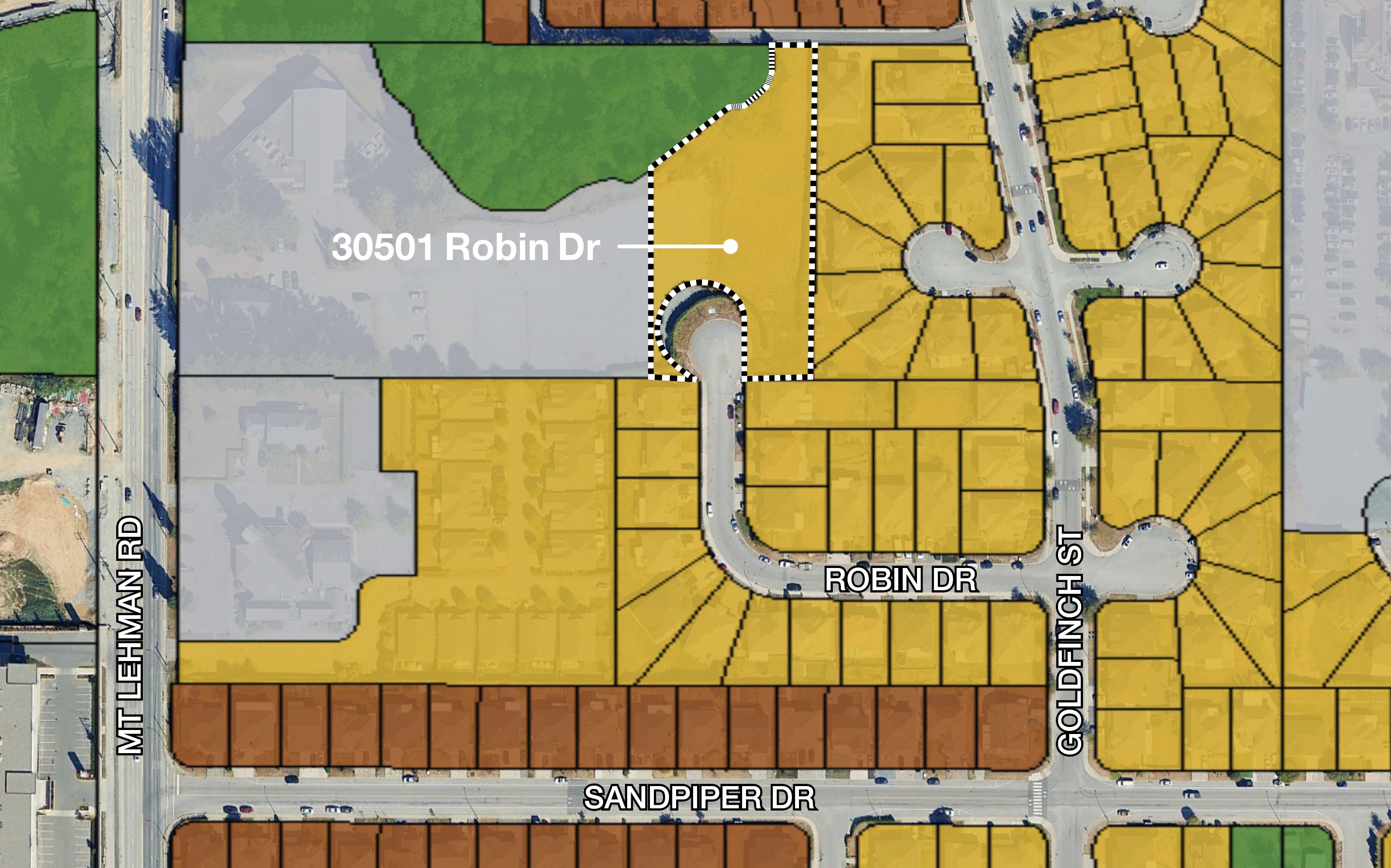
Where 30501 Robin Dr Why Align land use with existing RMG Townhouse zoning OCP designation today SSMUH 2 Corrected OCP designation Townhouse Amendment 7 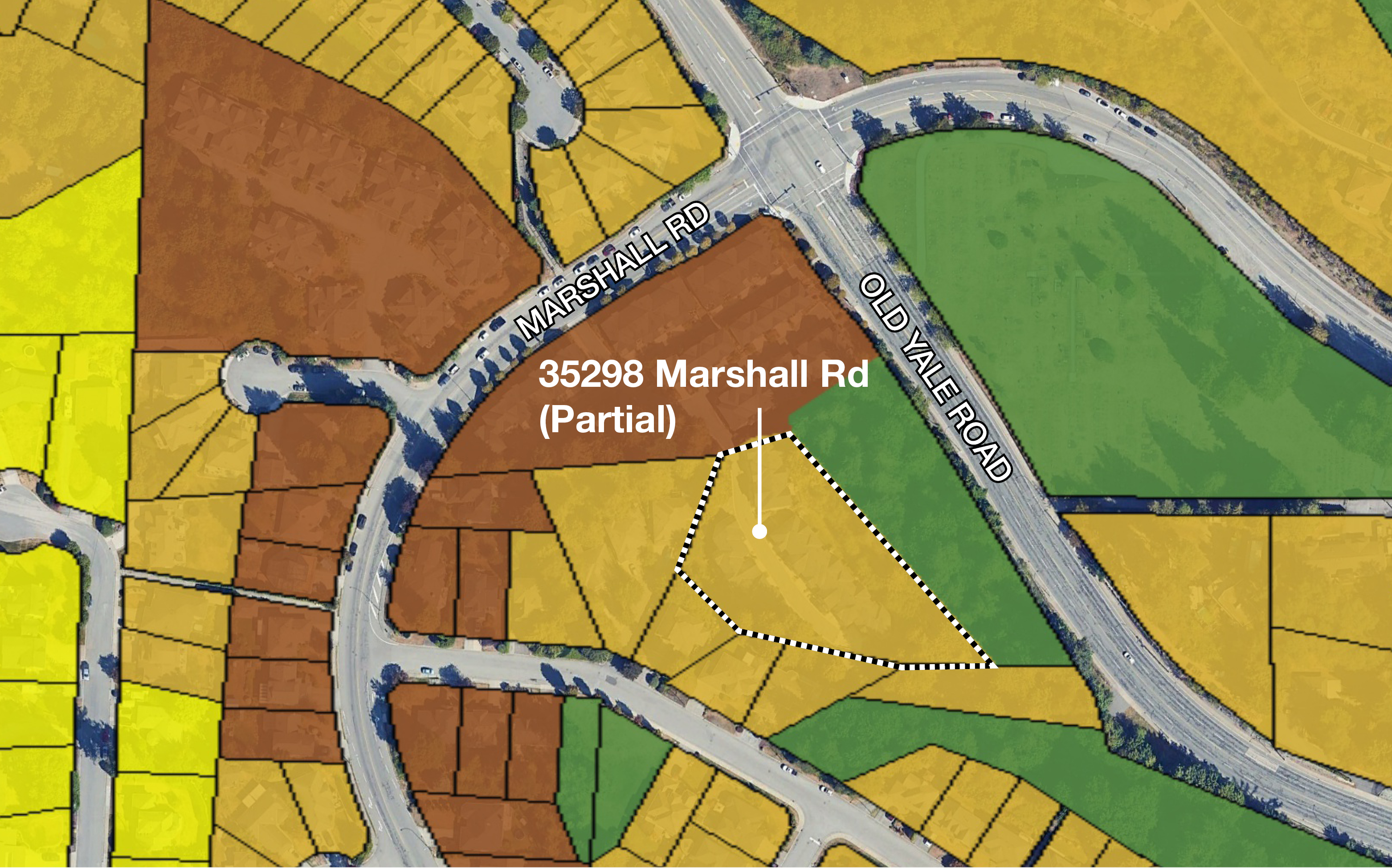
Where 35298 Marshall Rd (partial) Why Townhouse land use designation does not include the full extent of the existing townhouse development OCP designation today SSMUH 2 (partial) Corrected OCP designation Townhouse Amendment 8 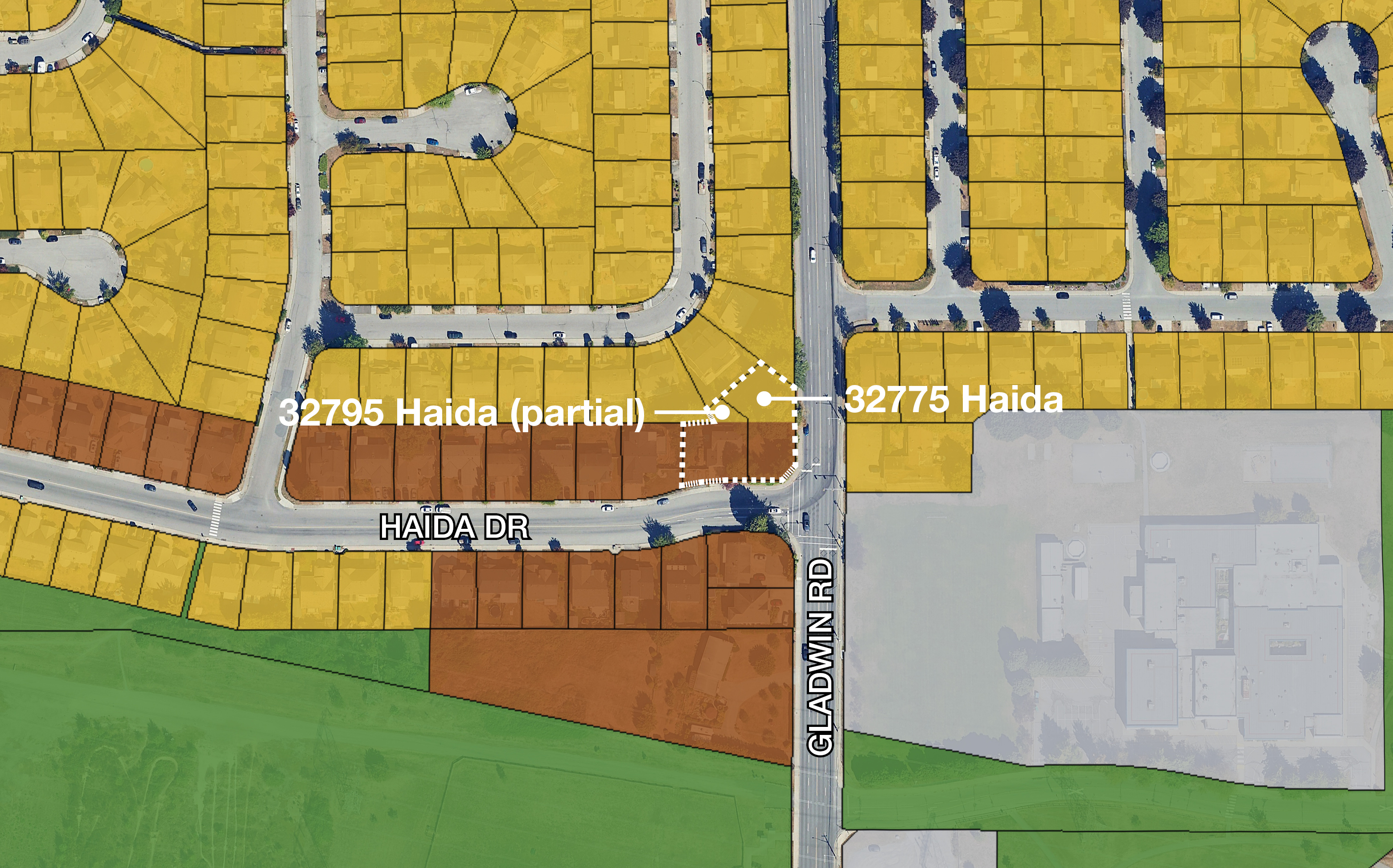
Where Portions of 32795 & 32775 Haida Dr Why Land use designation not aligned with parcel OCP designation today SSMUH 2 (partial) Corrected OCP designation Townhouse Amendment 9 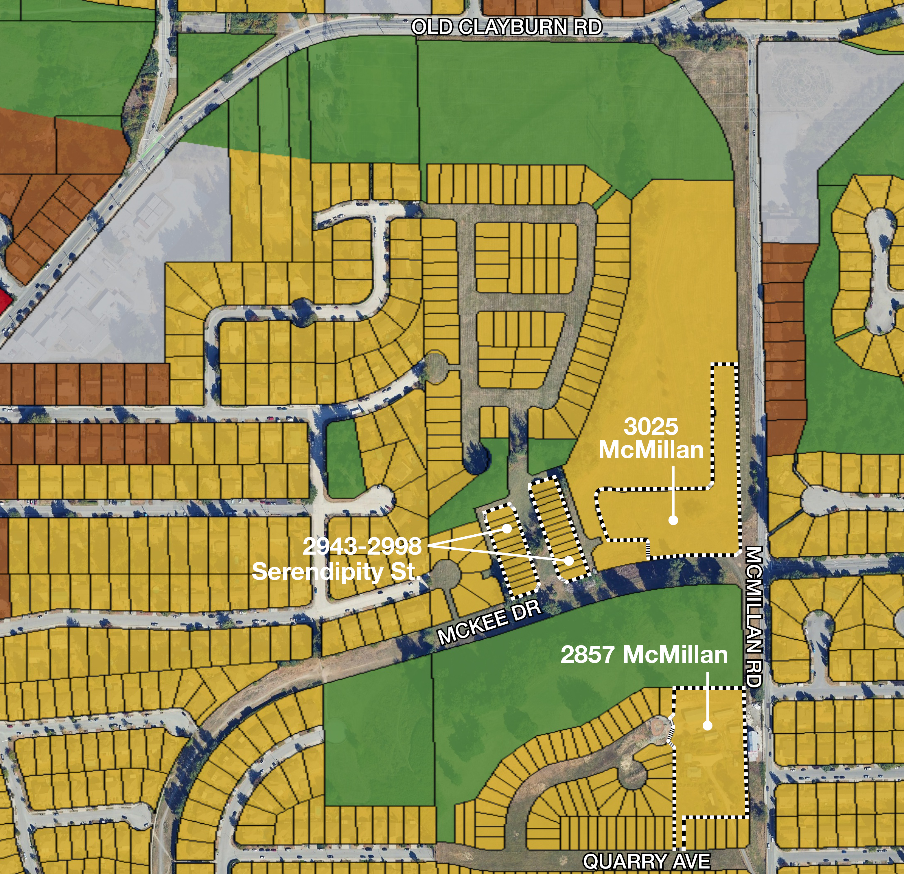
Where 3025 & 2857 (partial) McMillan Rd. - portion of Cooper Meadows Why Align land use with existing RMG townhouse and RMR rowhouse zoning OCP designation today SSMUH 2 Corrected OCP designation Townhouse Amendment 10 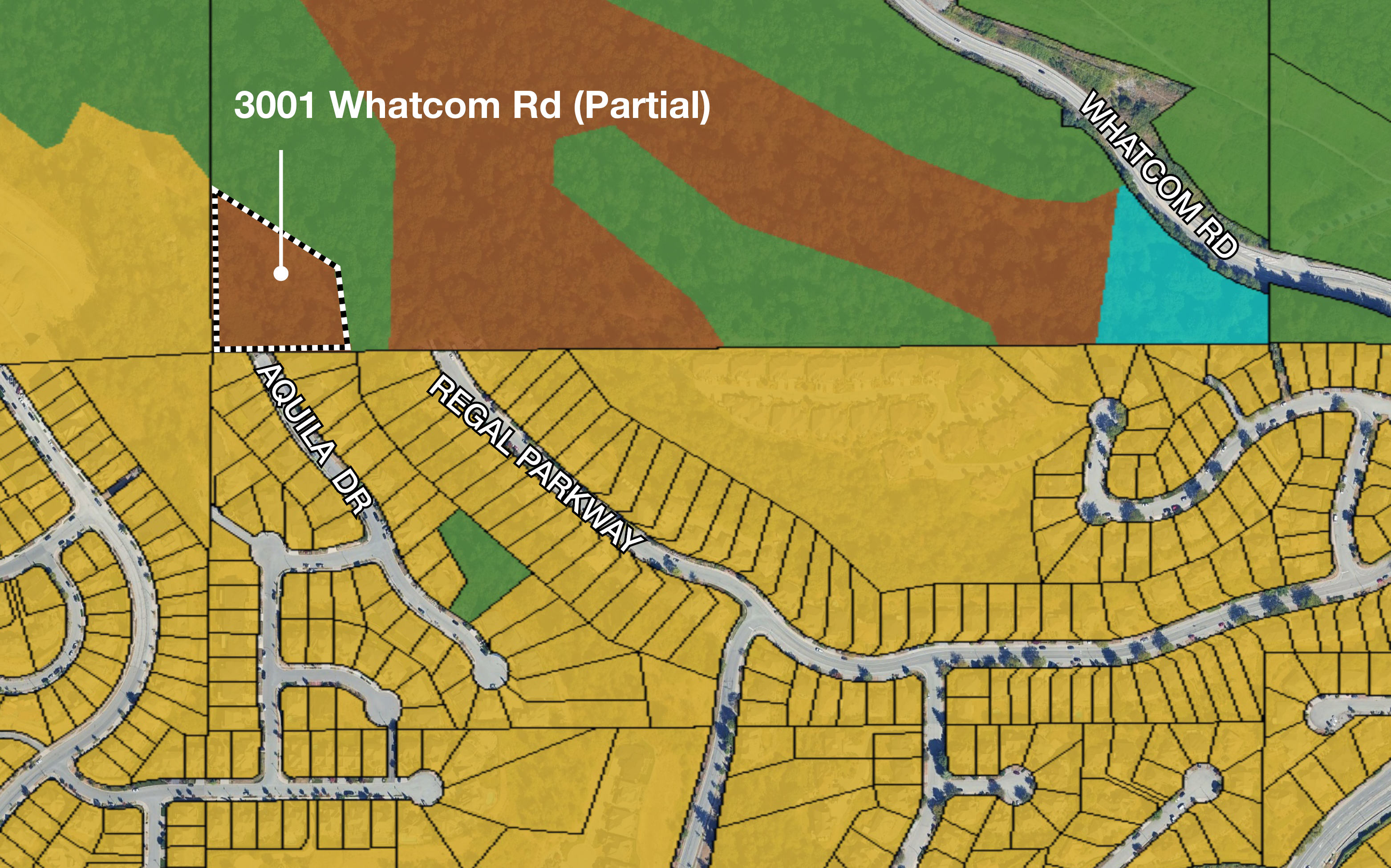
Where 3001 Whatcom Rd (partial) - access from Eagle Mountain Why Unintentional map change with Abbotsforward 2050 OCP designation today Townhouse Corrected OCP designation SSMUH 2 Amendment 11 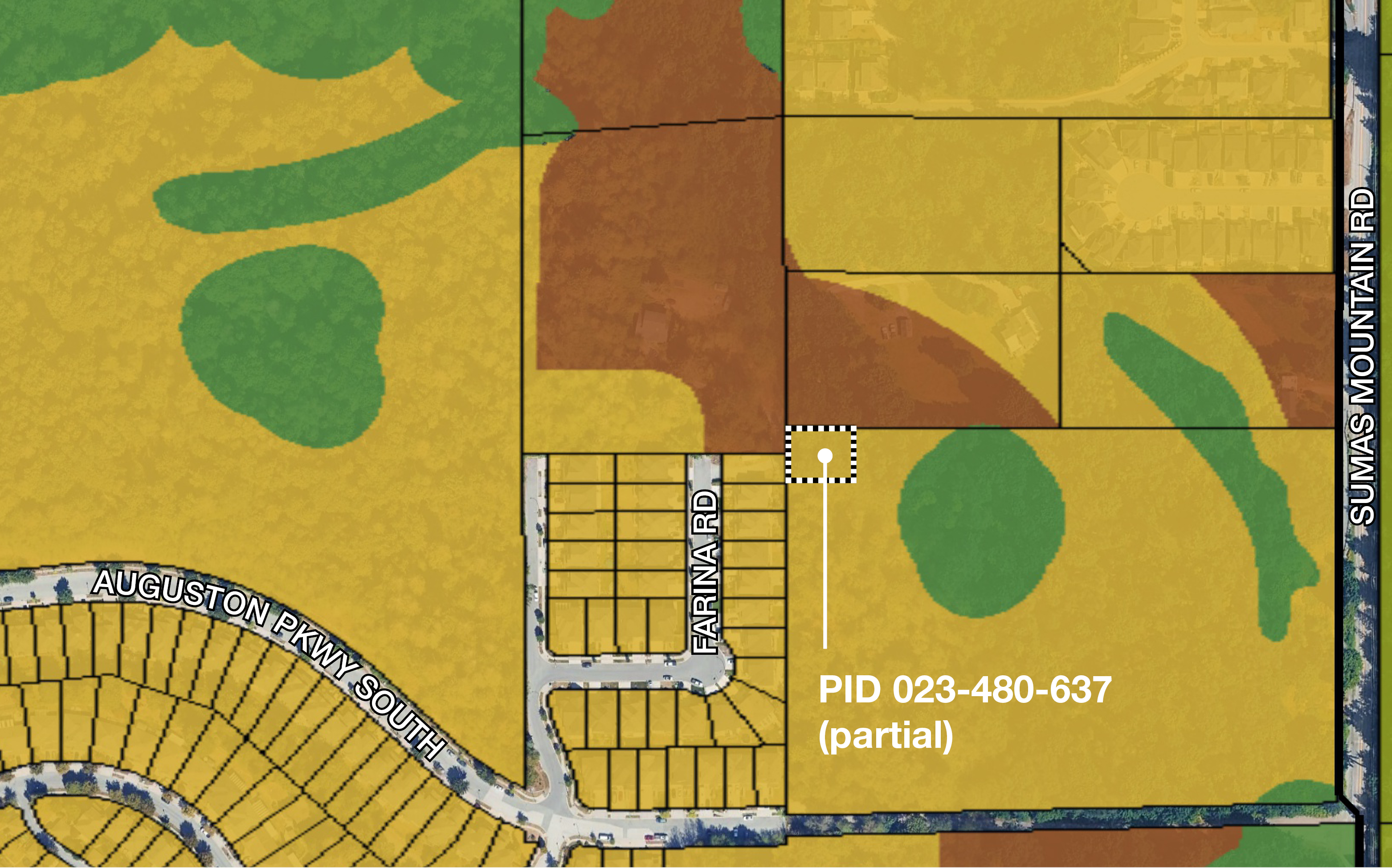
Where Portion of 4465 Sumas Mountain Rd (PID 023-480-637) Why Unintentional map change with Abbotsforward 2050 OCP designation today
SSMUH 2 Corrected OCP designation Townhouse (portion) -
OCP Map Correction (12)
Share OCP Map Correction (12) on Facebook Share OCP Map Correction (12) on X (formerly Twitter) Share OCP Map Correction (12) on Linkedin Email OCP Map Correction (12) linkAmendment 12 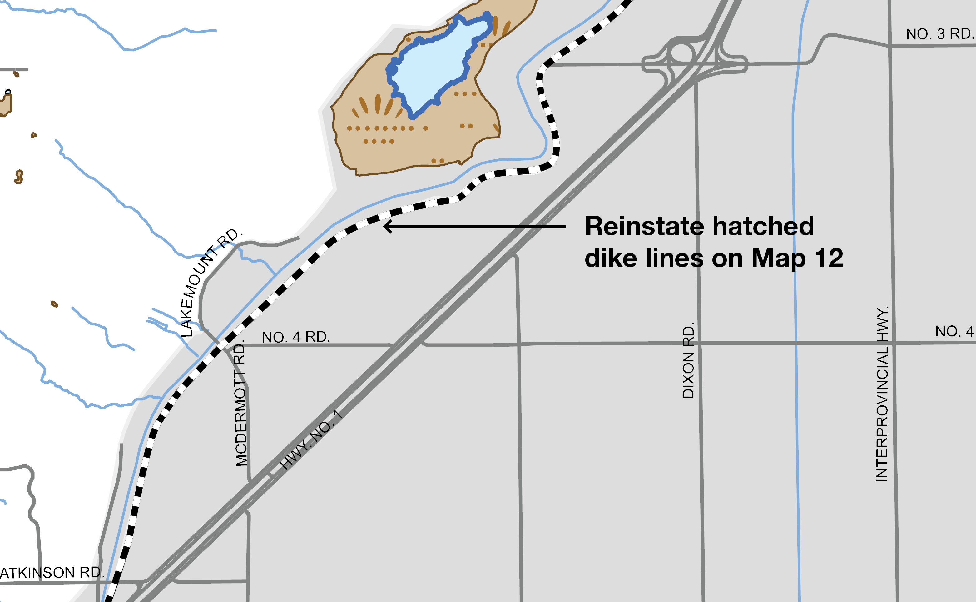
OCP Map 12 Drainage and Flood Control Issue Map lines for dike locations are not showing up correctly Proposed correction
Correct line hatching; the final OCP Amendment bylaw proposes to include additional drainage symbols representing existing infrastructure.
Reason Improves clarity/corrects formatting error
Page last updated: 02 Jul 2026, 11:47 AM
-

Phone 604-864-5620 Email rperry@abbotsford.ca