
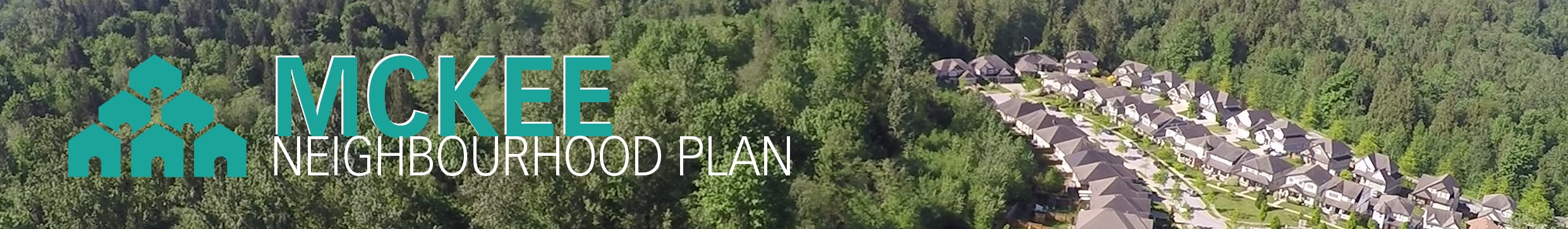
McKee Neighbourhood Plan
Consultation has concluded

Thank you for your feedback. View the final McKee Neighbourhood Plan.
The City of Abbotsford is creating a plan for the new McKee Neighbourhood, a mountainside area known for its open space and trails.
The four-stage planning process will develop a vision for a new residential neighbourhood anchored by a neighbourhood centre, and connected with trails, parks and open spaces. The Mckee Neighbourhood Plan presents an opportunity to combine homes, schools, parks, trails and environmental amenities into a neighbourhood that meets residents’ daily needs close to home.
-
Share In follow up to the response "A wildlife habitat Assessment was conducted and habitat for wildlife and species at risk was mapped and is shown on Map 7 (page 38). If you read the environment section of the plan which starts on page 36, it will detail our environmental approach which considers habitat for both large small mammals" the report does not review or discuss protection of non at risk species or larger animals. It refers to at risk species but I am curious about those that are currently not at risk? Are there considerations to protect those animals as well? on Facebook Share In follow up to the response "A wildlife habitat Assessment was conducted and habitat for wildlife and species at risk was mapped and is shown on Map 7 (page 38). If you read the environment section of the plan which starts on page 36, it will detail our environmental approach which considers habitat for both large small mammals" the report does not review or discuss protection of non at risk species or larger animals. It refers to at risk species but I am curious about those that are currently not at risk? Are there considerations to protect those animals as well? on X (formerly Twitter) Share In follow up to the response "A wildlife habitat Assessment was conducted and habitat for wildlife and species at risk was mapped and is shown on Map 7 (page 38). If you read the environment section of the plan which starts on page 36, it will detail our environmental approach which considers habitat for both large small mammals" the report does not review or discuss protection of non at risk species or larger animals. It refers to at risk species but I am curious about those that are currently not at risk? Are there considerations to protect those animals as well? on Linkedin Email In follow up to the response "A wildlife habitat Assessment was conducted and habitat for wildlife and species at risk was mapped and is shown on Map 7 (page 38). If you read the environment section of the plan which starts on page 36, it will detail our environmental approach which considers habitat for both large small mammals" the report does not review or discuss protection of non at risk species or larger animals. It refers to at risk species but I am curious about those that are currently not at risk? Are there considerations to protect those animals as well? link
In follow up to the response "A wildlife habitat Assessment was conducted and habitat for wildlife and species at risk was mapped and is shown on Map 7 (page 38). If you read the environment section of the plan which starts on page 36, it will detail our environmental approach which considers habitat for both large small mammals" the report does not review or discuss protection of non at risk species or larger animals. It refers to at risk species but I am curious about those that are currently not at risk? Are there considerations to protect those animals as well?
j asked about 4 years agoJ,
Thanks for the follow-up clarification. On page 36 the first sentence in the environment section sets the direction by stating that habitat for wildlife (including species at risk) are essential environmental features in the McKee neighbourhood to be protected. Large mammals such as bear and deer don’t have any formal senior government protection. However, the riparian areas and the wildlife linkages identified in the plan will provide habitat for all wildlife (including those that are at risk and those with healthy populations such as bear and deer).
Thanks
Mitch
-
Share How many kms of trail are being lost from this project? on Facebook Share How many kms of trail are being lost from this project? on X (formerly Twitter) Share How many kms of trail are being lost from this project? on Linkedin Email How many kms of trail are being lost from this project? link
How many kms of trail are being lost from this project?
C asked about 4 years agoC,
Within the plan area their are many informal trails built on private property. Through the planning process City staff have taken the approach of listening to all stakeholders who are interested in the plan and have tried to propose a solution that meets Official Community Plan policy, works with provincial requirements such as protecting watercourses, and works with the wishes of trail user groups.
If you look at the Stage 1 Background Research Report (page 41) there is approximately 50% of the 1901 acres within the plan area that will be left in a natural state. These lands can be used for trails and outdoor recreational pursuits. Within these areas many of the informal trails will be able to be kept in place. On page 51 of the Draft Plan there is a policy (3.55 McKee Trail Future Study) that stipulates that more detailed work will take place regarding the trail network and this will be in consultation with the community. Also policy 3.68 speaks to 'where interest is expressed, encourage partnerships with trail user groups for trail design and maintenance.' City staff have been meeting with the executives from both the FVMBA and the Abbotsford Trail Running Club and have started a dialog with regards to forming partnerships. if you would like to discuss trails further please call me on my direct line at 604-851-4174.
Thanks
Mitch
-
Share I saw this question by Peggy below "How is the city working with the School District to ensure that any development is done alongside school development? Schools in East Abbotsford are already overcapacity. I have noticed that Surrey councilors deny or amend building arrangements based on school capacity. I didn't notice this in the plan." It is unclear if the school board owns the land where the proposed school sites are located on the map. Can you please explain this? It is difficult to know if these schools will actually be built if the school board does not own the land and also becuase it involves provincial approval and funding. on Facebook Share I saw this question by Peggy below "How is the city working with the School District to ensure that any development is done alongside school development? Schools in East Abbotsford are already overcapacity. I have noticed that Surrey councilors deny or amend building arrangements based on school capacity. I didn't notice this in the plan." It is unclear if the school board owns the land where the proposed school sites are located on the map. Can you please explain this? It is difficult to know if these schools will actually be built if the school board does not own the land and also becuase it involves provincial approval and funding. on X (formerly Twitter) Share I saw this question by Peggy below "How is the city working with the School District to ensure that any development is done alongside school development? Schools in East Abbotsford are already overcapacity. I have noticed that Surrey councilors deny or amend building arrangements based on school capacity. I didn't notice this in the plan." It is unclear if the school board owns the land where the proposed school sites are located on the map. Can you please explain this? It is difficult to know if these schools will actually be built if the school board does not own the land and also becuase it involves provincial approval and funding. on Linkedin Email I saw this question by Peggy below "How is the city working with the School District to ensure that any development is done alongside school development? Schools in East Abbotsford are already overcapacity. I have noticed that Surrey councilors deny or amend building arrangements based on school capacity. I didn't notice this in the plan." It is unclear if the school board owns the land where the proposed school sites are located on the map. Can you please explain this? It is difficult to know if these schools will actually be built if the school board does not own the land and also becuase it involves provincial approval and funding. link
I saw this question by Peggy below "How is the city working with the School District to ensure that any development is done alongside school development? Schools in East Abbotsford are already overcapacity. I have noticed that Surrey councilors deny or amend building arrangements based on school capacity. I didn't notice this in the plan." It is unclear if the school board owns the land where the proposed school sites are located on the map. Can you please explain this? It is difficult to know if these schools will actually be built if the school board does not own the land and also becuase it involves provincial approval and funding.
jessicasuddaby asked about 4 years agoJessicasuddaby,
Thank-you for your question about schools within the plan. Staff ran a school age projection to determine the number of projected children at full build-out. Once projections were completed the school board was consulted on how many schools would be required to meet the forecasted demand. The result is found on Map 6, on page 36 of the draft plan. We are anticipating 2 new elementary schools, one middle school and one secondary school. The School District doesn't own all of the sites at this time, and policy 3.24 is proposed to help the school district acquire the schools when they will need them. Developers will be required to secure the sites at the time of development, and hold the land until such time as the School District is ready to purchase them when the demand is in place. The projected build-out for the plan is somewhere between 20 to 40 years depending on the state of our economy and ensuing growth.
Mitch
-
Share Have there been studies to determine the number of large animals living in this area and how will they be protected during development and construction? As local trail users know there are plenty of black bear families, cougars that roam through, and coyotes making this mountain their home. This year there was a bear den in a hollowed out tree, and there are new cubs spotted each spring. How will they be protected and cared for during this process? on Facebook Share Have there been studies to determine the number of large animals living in this area and how will they be protected during development and construction? As local trail users know there are plenty of black bear families, cougars that roam through, and coyotes making this mountain their home. This year there was a bear den in a hollowed out tree, and there are new cubs spotted each spring. How will they be protected and cared for during this process? on X (formerly Twitter) Share Have there been studies to determine the number of large animals living in this area and how will they be protected during development and construction? As local trail users know there are plenty of black bear families, cougars that roam through, and coyotes making this mountain their home. This year there was a bear den in a hollowed out tree, and there are new cubs spotted each spring. How will they be protected and cared for during this process? on Linkedin Email Have there been studies to determine the number of large animals living in this area and how will they be protected during development and construction? As local trail users know there are plenty of black bear families, cougars that roam through, and coyotes making this mountain their home. This year there was a bear den in a hollowed out tree, and there are new cubs spotted each spring. How will they be protected and cared for during this process? link
Have there been studies to determine the number of large animals living in this area and how will they be protected during development and construction? As local trail users know there are plenty of black bear families, cougars that roam through, and coyotes making this mountain their home. This year there was a bear den in a hollowed out tree, and there are new cubs spotted each spring. How will they be protected and cared for during this process?
j asked about 4 years agoJ,
A wildlife habitat Assessment was conducted and habitat for wildlife and species at risk was mapped and is shown on Map 7 (page 38). If you read the environment section of the plan which starts on page 36, it will detail our environmental approach which considers habitat for both large small mammals. if you have further questions I would be happy to chat with you and my direct line is 604-851-4174.
Mitch
-
Share Why are Abbotsford residents losing so many trails with this development? How many trails will be replaced? Ledgeview is one of our main, small mountain for outdoor activities and there is no solution for what is being lost. Population goes up while we lose trails to support our outdoor community. Mill lake and discovery trail is no sufficient. on Facebook Share Why are Abbotsford residents losing so many trails with this development? How many trails will be replaced? Ledgeview is one of our main, small mountain for outdoor activities and there is no solution for what is being lost. Population goes up while we lose trails to support our outdoor community. Mill lake and discovery trail is no sufficient. on X (formerly Twitter) Share Why are Abbotsford residents losing so many trails with this development? How many trails will be replaced? Ledgeview is one of our main, small mountain for outdoor activities and there is no solution for what is being lost. Population goes up while we lose trails to support our outdoor community. Mill lake and discovery trail is no sufficient. on Linkedin Email Why are Abbotsford residents losing so many trails with this development? How many trails will be replaced? Ledgeview is one of our main, small mountain for outdoor activities and there is no solution for what is being lost. Population goes up while we lose trails to support our outdoor community. Mill lake and discovery trail is no sufficient. link
Why are Abbotsford residents losing so many trails with this development? How many trails will be replaced? Ledgeview is one of our main, small mountain for outdoor activities and there is no solution for what is being lost. Population goes up while we lose trails to support our outdoor community. Mill lake and discovery trail is no sufficient.
N asked about 4 years agoN,
The mountain is privately owned and has been for decades. the trail network is not city owned and our Official Community Plan has identified this area for sensitive residential growth. Map 14 in the draft plan shows the future trail corridors but this is not indicative of the actual number of trails. Policy 3.55 on page 51 of the draft plan talks about how the Parks department will be conducting a future study that will look into the specifics of the individual trails.
Thanks
Mitch
-
Share How will highway 1 whatcom exit accommodate such an increase in population? Is there a plan to modify that infrastructure to avoid major congestion on the hwy1 itself and at the interchange? Is the city working with other levels of government to ensure this important infrastructure is modified BEFORE all the residents come pouring in? on Facebook Share How will highway 1 whatcom exit accommodate such an increase in population? Is there a plan to modify that infrastructure to avoid major congestion on the hwy1 itself and at the interchange? Is the city working with other levels of government to ensure this important infrastructure is modified BEFORE all the residents come pouring in? on X (formerly Twitter) Share How will highway 1 whatcom exit accommodate such an increase in population? Is there a plan to modify that infrastructure to avoid major congestion on the hwy1 itself and at the interchange? Is the city working with other levels of government to ensure this important infrastructure is modified BEFORE all the residents come pouring in? on Linkedin Email How will highway 1 whatcom exit accommodate such an increase in population? Is there a plan to modify that infrastructure to avoid major congestion on the hwy1 itself and at the interchange? Is the city working with other levels of government to ensure this important infrastructure is modified BEFORE all the residents come pouring in? link
How will highway 1 whatcom exit accommodate such an increase in population? Is there a plan to modify that infrastructure to avoid major congestion on the hwy1 itself and at the interchange? Is the city working with other levels of government to ensure this important infrastructure is modified BEFORE all the residents come pouring in?
Mariadawes asked about 4 years agoMaria Dawes,
Thank you for your question and input. The Highway 1 corridor is currently in the design phase for widening initiatives by the Ministry of Transportation and Infrastructure from 264 Street to Whatcom Road. The Whatcom Road interchange will be modified to the proposed highway widening (additional lanes) and to accommodate further traffic growth between the highway and the City of Abbotsford , including the new McKee Neighbourhood. Further details on the construction of the widening will be available to the public, at the discretion of the Ministry.
Thanks
Mitch
-
Share I have gone through the stage 2 and stage 3 report but I do not see a proposed map of trails. Is there one in these reports? Would most of the trails be proposed in the greenspace that is on a 30% grade or more slope where housing development cannot take place? Has consideration been given to linking these trails through the neighborhoods? What I mean by this is providing trail entrance/exit areas on multiple streets so that recreational users can connect from one trail to another via street where they would previously have connected on a trail. on Facebook Share I have gone through the stage 2 and stage 3 report but I do not see a proposed map of trails. Is there one in these reports? Would most of the trails be proposed in the greenspace that is on a 30% grade or more slope where housing development cannot take place? Has consideration been given to linking these trails through the neighborhoods? What I mean by this is providing trail entrance/exit areas on multiple streets so that recreational users can connect from one trail to another via street where they would previously have connected on a trail. on X (formerly Twitter) Share I have gone through the stage 2 and stage 3 report but I do not see a proposed map of trails. Is there one in these reports? Would most of the trails be proposed in the greenspace that is on a 30% grade or more slope where housing development cannot take place? Has consideration been given to linking these trails through the neighborhoods? What I mean by this is providing trail entrance/exit areas on multiple streets so that recreational users can connect from one trail to another via street where they would previously have connected on a trail. on Linkedin Email I have gone through the stage 2 and stage 3 report but I do not see a proposed map of trails. Is there one in these reports? Would most of the trails be proposed in the greenspace that is on a 30% grade or more slope where housing development cannot take place? Has consideration been given to linking these trails through the neighborhoods? What I mean by this is providing trail entrance/exit areas on multiple streets so that recreational users can connect from one trail to another via street where they would previously have connected on a trail. link
I have gone through the stage 2 and stage 3 report but I do not see a proposed map of trails. Is there one in these reports? Would most of the trails be proposed in the greenspace that is on a 30% grade or more slope where housing development cannot take place? Has consideration been given to linking these trails through the neighborhoods? What I mean by this is providing trail entrance/exit areas on multiple streets so that recreational users can connect from one trail to another via street where they would previously have connected on a trail.
jessicasuddaby asked about 4 years agoJessicasuddaby,
Thanks for your question. For the Neighbourhood Plan we are only showing the trail corridors, not the trails themselves. Policy 3.55 (page 51) of the Draft Plan stipulates that our Parks team will get into the specifics of the trail network in the future. Trails will be located on in streamside protection areas as well as on slopes that are unsuitable for development.
We have also taken a similar approach with infrastructure as well. If you notice we are only showing the collector roads and not every local street. These will come later through development.
Thanks
Mitch
-
Share I am concerned about the destruction of existing trails if this project goes ahead as planned. It seems animals will be left with no other choice than to move onto busier human areas, and people are going to lose a large recreational area. The proposed trails decrease opportunities to bike, run, and hike in the outdoors as well as endanger animals by forcing them into contact with more people. Is there a way to alter the plan to conserve a greater area of wild green space and preserve some of the existing trail infrastructure? on Facebook Share I am concerned about the destruction of existing trails if this project goes ahead as planned. It seems animals will be left with no other choice than to move onto busier human areas, and people are going to lose a large recreational area. The proposed trails decrease opportunities to bike, run, and hike in the outdoors as well as endanger animals by forcing them into contact with more people. Is there a way to alter the plan to conserve a greater area of wild green space and preserve some of the existing trail infrastructure? on X (formerly Twitter) Share I am concerned about the destruction of existing trails if this project goes ahead as planned. It seems animals will be left with no other choice than to move onto busier human areas, and people are going to lose a large recreational area. The proposed trails decrease opportunities to bike, run, and hike in the outdoors as well as endanger animals by forcing them into contact with more people. Is there a way to alter the plan to conserve a greater area of wild green space and preserve some of the existing trail infrastructure? on Linkedin Email I am concerned about the destruction of existing trails if this project goes ahead as planned. It seems animals will be left with no other choice than to move onto busier human areas, and people are going to lose a large recreational area. The proposed trails decrease opportunities to bike, run, and hike in the outdoors as well as endanger animals by forcing them into contact with more people. Is there a way to alter the plan to conserve a greater area of wild green space and preserve some of the existing trail infrastructure? link
I am concerned about the destruction of existing trails if this project goes ahead as planned. It seems animals will be left with no other choice than to move onto busier human areas, and people are going to lose a large recreational area. The proposed trails decrease opportunities to bike, run, and hike in the outdoors as well as endanger animals by forcing them into contact with more people. Is there a way to alter the plan to conserve a greater area of wild green space and preserve some of the existing trail infrastructure?
Devon asked about 4 years agoDevon,
Map 14 is a trail corridor map and is not indicative of the number of trails that will be in place when the plan is completely built-out somewhere between 20 to 40 years from now. if you check out policy 3.55 on Page 51 there will be a further study conducted by City Parks staff that will get into the actual trail details and design. For the Neighbourhood Plan we have only identified the corridors for trails, and have shown an intention to have trails in certain areas. We have taken the same approach with infrastructure as well. For example we are only showing collector roads and not local roads, as these will be planned later through individual developer applications. Also, the areas for the corridors are fairly wide in some areas. For example some of the trail corridors around watercourses are just over 200 ft wide (60 m) and will provide some definite space for both people and animals.
Thanks
Mitch
-
Share Is there a breakdown by years, to see the steps and timeframe for completion? Have ball diamonds and ice hockey rinks been taken into consideration as we add more population? on Facebook Share Is there a breakdown by years, to see the steps and timeframe for completion? Have ball diamonds and ice hockey rinks been taken into consideration as we add more population? on X (formerly Twitter) Share Is there a breakdown by years, to see the steps and timeframe for completion? Have ball diamonds and ice hockey rinks been taken into consideration as we add more population? on Linkedin Email Is there a breakdown by years, to see the steps and timeframe for completion? Have ball diamonds and ice hockey rinks been taken into consideration as we add more population? link
Is there a breakdown by years, to see the steps and timeframe for completion? Have ball diamonds and ice hockey rinks been taken into consideration as we add more population?
Madtrapper asked about 4 years agoMadtrapper,
Thanks for your question. We don't have a detailed breakdown for full build-out of the neighbourhood. There are many factors which will influence the timeframe such as how the economy performs etc. However, an estimate would be somewhere between 20 to 40 years. As far as recreational service provision, our Parks and Recreational Department are examining these types of services City wide in the next few years to make sure all parts of the City are well served.
Cheers
Mitch
-
Share In the last couple years that this draft has been in development, housing affordability has dramatically changed. Can this draft be adapted to increase the ratio of higher density housing options rather than exclusive single family dwellings so close to public amenities? on Facebook Share In the last couple years that this draft has been in development, housing affordability has dramatically changed. Can this draft be adapted to increase the ratio of higher density housing options rather than exclusive single family dwellings so close to public amenities? on X (formerly Twitter) Share In the last couple years that this draft has been in development, housing affordability has dramatically changed. Can this draft be adapted to increase the ratio of higher density housing options rather than exclusive single family dwellings so close to public amenities? on Linkedin Email In the last couple years that this draft has been in development, housing affordability has dramatically changed. Can this draft be adapted to increase the ratio of higher density housing options rather than exclusive single family dwellings so close to public amenities? link
In the last couple years that this draft has been in development, housing affordability has dramatically changed. Can this draft be adapted to increase the ratio of higher density housing options rather than exclusive single family dwellings so close to public amenities?
PTE asked about 4 years agoPTE,
Thanks for your question and interest in the McKee Neighbourhood Plan. Yes, housing affordability has changed but the City has focused 75 percent of its new growth in the existing urban part of the City, and many new apartments have been built and will continue to be built in this area. The mountain environment doesn't lend itself well to certain types of development such as larger apartment buildings due to slope and geotechnical reasons. However, within the McKee Village there will be 6 storey apartment buildings. A significant effort has also been made to allow for as many townhouse sites as possible ( See map 3 Urban 2 - land use). Urban 4 which is the largest land use also allows for townhouse sites when sites are larger than 1 hectare in size so you should see a number of Townhouse projects in the future.
Thanks
Mitch
Who's Listening
-
Phone 604-851-4174 Email mcomb@abbotsford.ca
View the Proposed Bylaw!

Project Timeline
-
Stage 1 - Background Research
McKee Neighbourhood Plan has finished this stageStage 1 analyzed existing conditions to assess the development potential of the land and determine what land should be protected according to senior government legislation and Council Policy.
McKee Neighbourhood Plan - Background Research Report
-
Stage 2 - Exploring Options
McKee Neighbourhood Plan has finished this stageStage 2 focused on creating options based on the outcomes of Stage 1 and undertaking a broad engagement process to select the preferred concept. Stage 2 also included preliminary technical analyses of infrastructure needs.
McKee Neighbourhood Plan Stage 2 Concept Report
-
Stage 3 - Draft Plan
McKee Neighbourhood Plan has finished this stageStage 3 focused on the preparation of the Draft McKee Neighbourhood Plan. Building on the findings of Stages 1 and 2, the Draft Plan establishes and vision for the neighbourhood and provides the tools for achieving it. Stage 3 also included a technical analysis of infrastructure needs and a complete Transportation Impact Assessment.
Draft McKee Neighbourhood Plan
-
Stage 4 - Final Plan
McKee Neighbourhood Plan is currently at this stageStage 4 will focus on refining the new McKee Neighbourhood Plan and having it adopted as a bylaw by Council.
Proposed Bylaw (Bylaw No. 3400-2023)
Documents
-
 Background Research Report - McKee Neighbourhood Plan (83.6 MB) (pdf)
-
McKee Neighbourhood Plan – Stage 1 Council Presentation (6.99 MB) (pdf)
-
McKee Neighbourhood Plan Stage 2 Concept Report (63.6 MB) (pdf)
-
McKee Neighbourhood Plan - Stage 2 Council Presentation (17.2 MB) (pdf)
-
PDS 012-2022, McKee Neighbourhood Plan Stage 2 Concept Report.pdf (349 KB) (pdf)
-
PDS 091-2020, Stage 1 Background Research McKee Neighbourhood Plan.pdf (253 KB) (pdf)
-
Stage 4 Council Report (Report No. PDS 078-2023).pdf (16.8 MB) (pdf)
-
Proposed Bylaw (Bylaw No. 3400-2023).pdf (21.6 MB) (pdf)
-
Stage 4 Council Presentation.pdf (28.3 MB) (pdf)
